Foggieloan
Foggie 2000
A Photographic Record

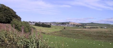
What follows is a photographic record of the Burgh of Aberchirder during the year 2000.  Some views were re-photographed a little later.  This project was undertaken as part of the millennium celebrations and it is hoped that these images will be enjoyed by many people (not just 'Foggieloaners') for years to come.
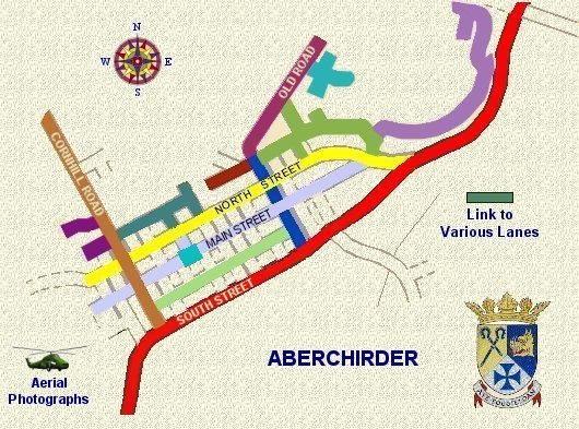
To find your way around this section of the site, you can click on an area of the map below (take care - some streets are split north and south side) or use the street name index to navigate.  Pictures on the longer streets are mostly arranged in the order 'up one side and down the other'.  Buildings on some shorter linking roads can generally be viewed on the pages containing the major streets.  Clicking on thumbnail images will open a full size picture on a new page.

Street Index
Boyes Lane Moss Road
Causewayend Crescent (upper side) North Street (north side)
Causewayend Crescent (lower side) North Street (south side)
Causewayend Place Old Road
Cornhill Road Parkview
Corskie Drive Rennie's Lane
Cranna View School Lane
Hardie Court Smith Crescent
Harris Way South Street
Hill View Southview Terrace
Kinnie's Lane Taylor Drive
Lanes (various) The Square
Main Street (north side) Wellfield Lane
Main Street (south side) Wellfield Terrace
Meadow Court West's Way

Aerial Photographs           Navigation Map


 All images are copyright to Donald D Graham - All rights reserved

Home   Activities   Businesses/Services   Community   Virtual Museum   Gift Shop   Site Map   Contact Us   Guest Book   Foggie News   Links

© ADCA Aberchirder, North-East Scotland 2002-2010.

.