|
|
Foggieloan Virtual Museum |
|
|
Foggieloan Virtual Museum |
![]()
THE GROWTH OF ABERCHIRDER
Gradual Growth in the 19th Century
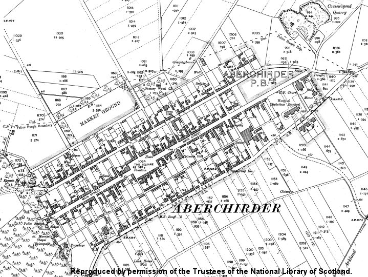
Map of 1866
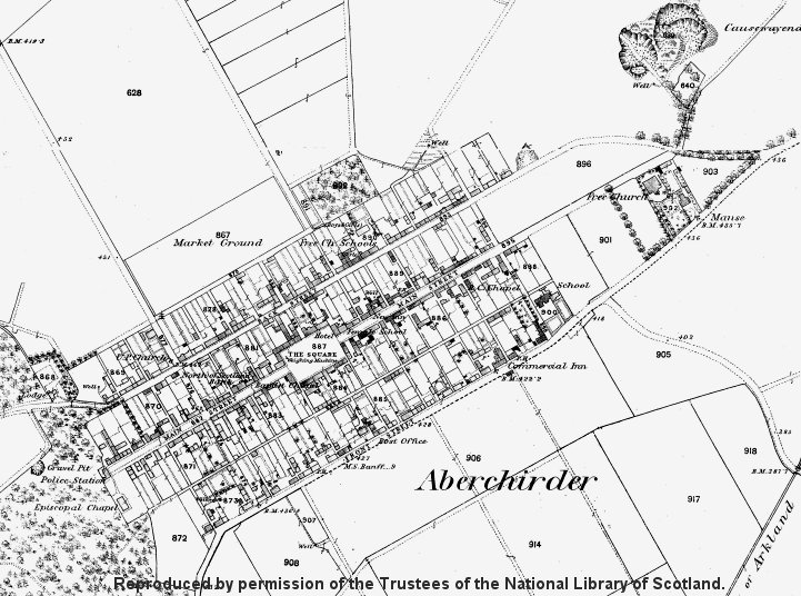
Click on the image to open a larger map in a new window.
Although Alexander Gordon’s hopes of a thriving industrial village were never realised, Aberchirder did continue to expand as its population grew, reaching an all-time peak of 1400 in 1881. The whole area between Back Street (North Street) and Front Street (South Street) had been built on, from the edge of Cleanhill in the west to just beyond what is now School Lane in the east.
|
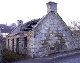
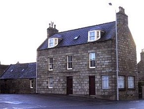
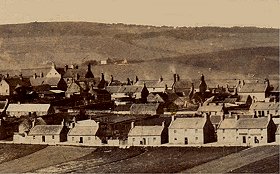
Many of the houses were incredibly small by today’s standards, and often families of ten or more lived in one 4.5metre by 4.5metre room. If you look at the gable end of the building on the right you will see how low the roof line was originally. |
|
|
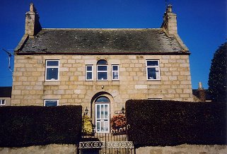
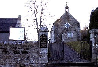
At the same time, however, much grander houses had also been built by the town’s professionals. Public buildings appeared, including a town hall, a bank, hotels and churches. |
|
|
|
|
|
|
|
New Building in the First Half of the 20th Century
Map of 1904
Click on the image to open a larger map in a new window.
The start of the 20th Century was a time when many towns and villages experienced a building boom when wealthy people either built new properties or improved existing ones. Evidence of this can be seen in the date stones, slated roofs and heightening or added storeys of the time, and Foggie is no exception.
|
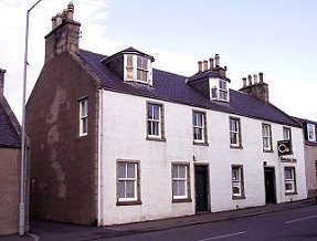
These new properties had modern facilities including electric light and inside WCs, instead of the oil lamps and outside dry toilets which were the norm. But in the 1920s and 1930s, more and more of the traditional houses – especially in South Street and the Long Lane - were being declared unfit for human habitation and the Council reluctantly began to build houses for rent. The first ones were located on vacant ground at the east end of North Street, but the people who were in need of re-housing could not afford the rent, so the first tenants included a school teacher and a butcher! |
|
|
|
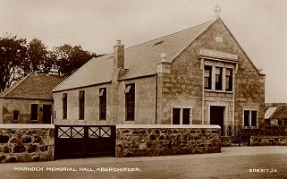
The one public building erected in the 1920s was the Memorial Hall, built by public subscription to honour the dead of World War One. It was added to the old 1841 Town Hall in North Street. Both halls were demolished on safety grounds in 2003. (Valentine's Postcard Contributed by Bob Peden) |
The Second Half of the 20th Century
In the years after World War Two the Council continued replacing many of the old properties on South Street and the Long Lane (Southview Terrace). The photographs below show a section of South Street before and after rebuilding took place. The Commercial Hotel appears in the far right of each image.
 (Photograph Contributed by Archie McBain, Banff) |
 Council built houses on South Street |
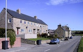
But in the second half of the 20th Century, Aberchirder was transformed as it spread out of its traditional area to the north-east. After starting on a small scale at Wellfield in the 1950s, the Council embarked on a massive programme of house building from the mid-1960s onwards. Around 1970, L A Anderson (builder) began the development of private housing at Causewayend, which is still in progress today.
Another trend has been for property owners in the original parts of Aberchirder to sell off part of their long gardens by splitting their feus. Most of these original long and narrow sites had principal roads at either end and this has allowed buyers to build modern houses with a street frontage.

So today Aberchirder has many more houses than it did a century ago, despite the fact that its population is slightly smaller – reflecting the huge improvements in living standards over the period.
![]()
To view other images of the growth of Foggie, please visit
The Gallery
Copyright © 2002 –
ADCA Aberchirder, North East Scotland.