Turnpike Roads
In the 18th Century people used a network of paths and tracks which in modern times became known as rights of way. Goods were usually carried on horseback rather in carts as the surfaces were so bad. This bridge is on the old cart track that runs from the end of the Backieley road past Craigiebrae and along to near Monedie. From old maps it appears this was the original route from Blacklaw to Marnoch and on to Huntly.
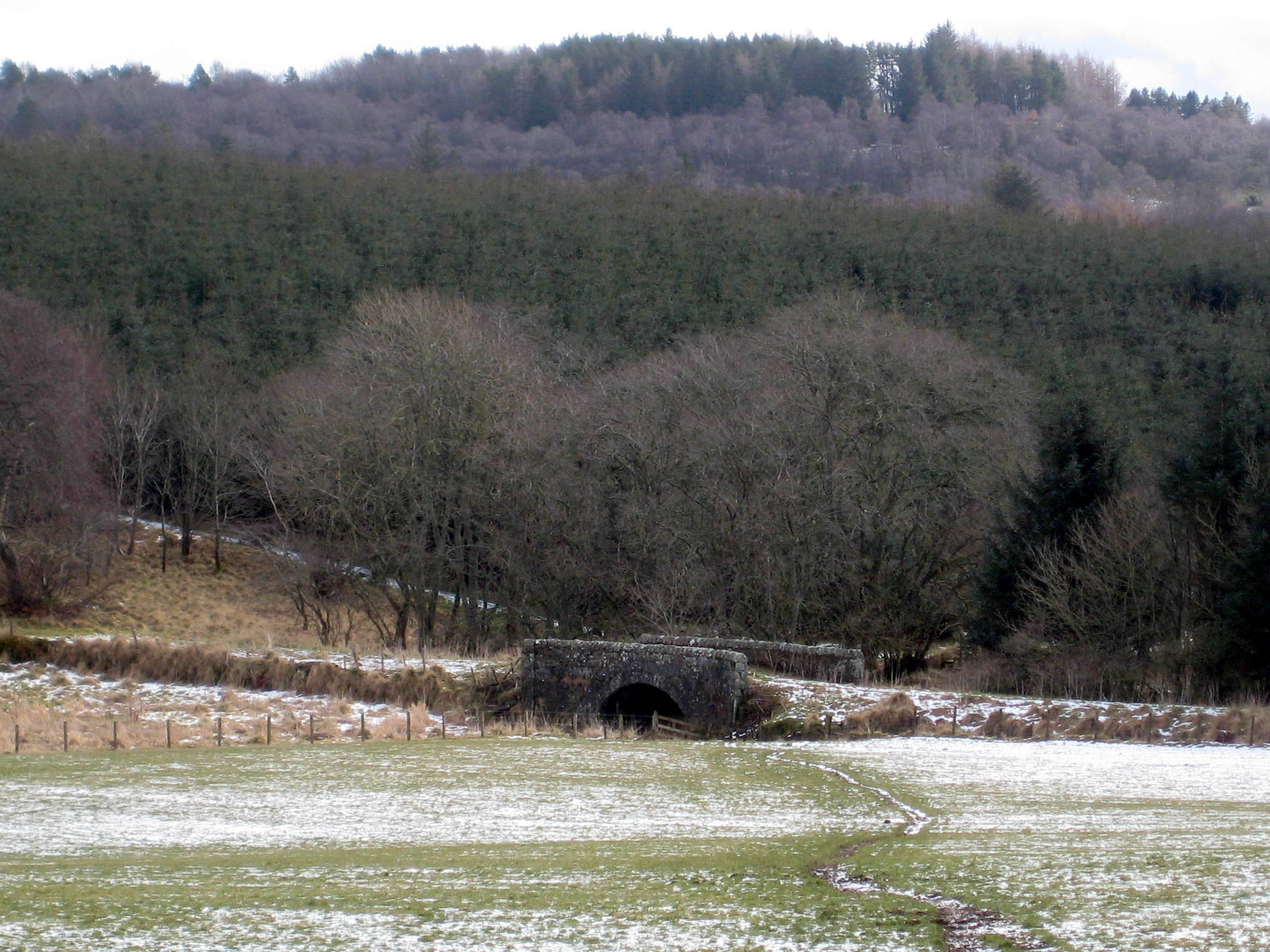
Old Bridge Of Monedie
Transport began to improve in the late 18th Century when landowners and industrialists realised that their incomes would only improve if farm and factory produce could be sent to markets in quantity. So they began to invest in turnpike trusts, which built good quality roads that could be used by heavy carts – and also by stagecoaches which allowed wealthy people, at least, to travel.
Aberchirder was served by a turnpike road from 1808, when Thomas Shier’s road from Banff to Huntly was completed.
These extracts are taken from his original survey map:
Map 2 – Shier proposed two alternative routes. The most direct route followed the lines of the old road from Blacklaw, past Backieley and on to Craigiebrae while a new route via Corskie, which he preferred because there was much less moss, making a road cheaper to build. The route eventually chosen for the turnpike ran past the end of the Turriff road at Little Corskie then deviated south of the track that ran from Corskie to the end of Main Street.
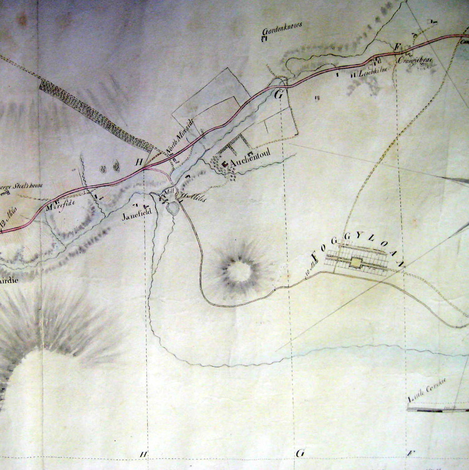
Map 3 shows how Shier’s route, on the line of today’s South Street, in effect bypassed ‘Foggyloan’, which at that time had only Mid Street (now Main Street) and Back Street (North Street).
Map 4 shows how the old route continued west of Auchintoul House to near Bridge of Auchintoul, while the turnpike ran south of Foggyloan and round Cleanhill. Shier’s comment on this route was that it saved a bridge on the Burn of Auchintoul and “going by Foggieloan which has been lately made”.
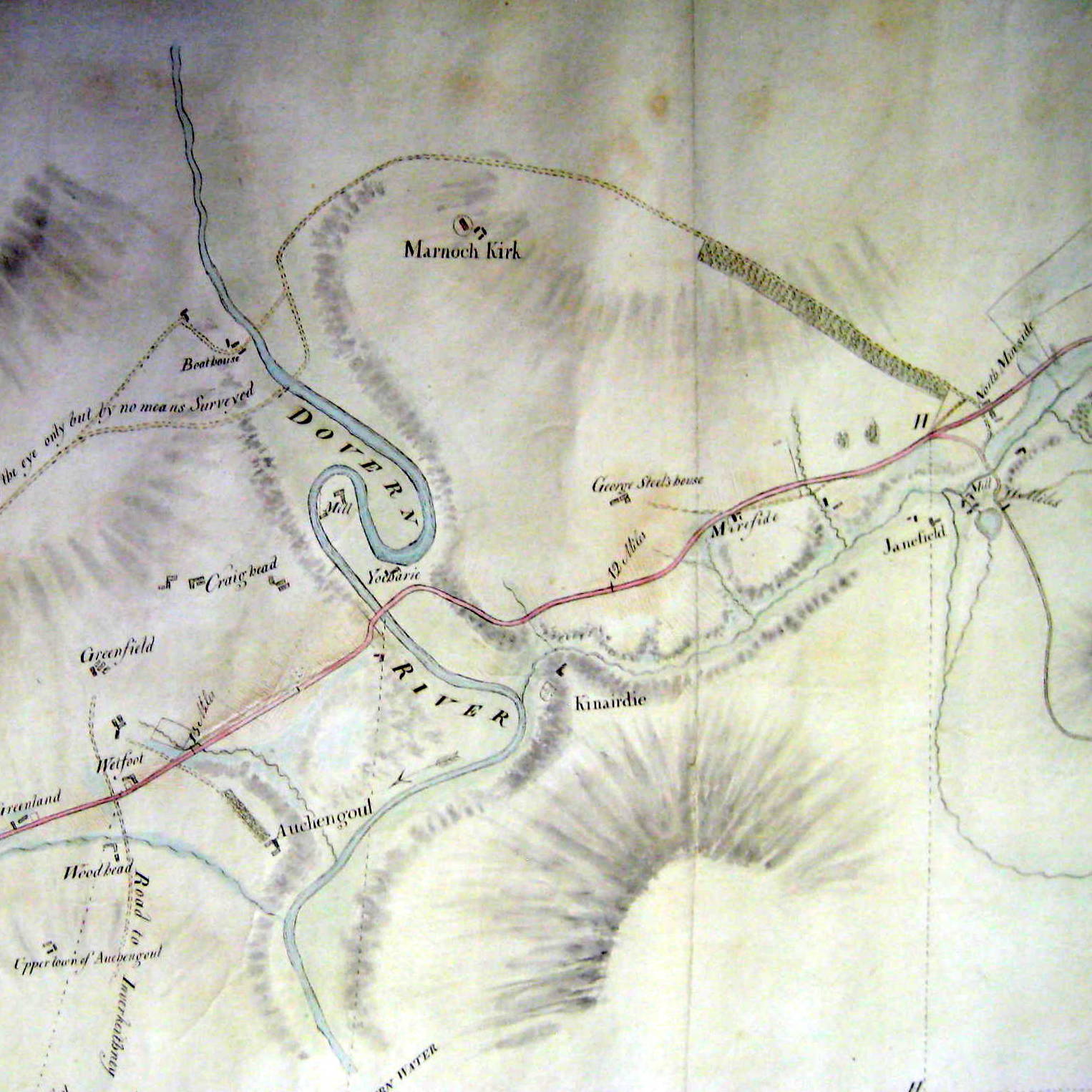
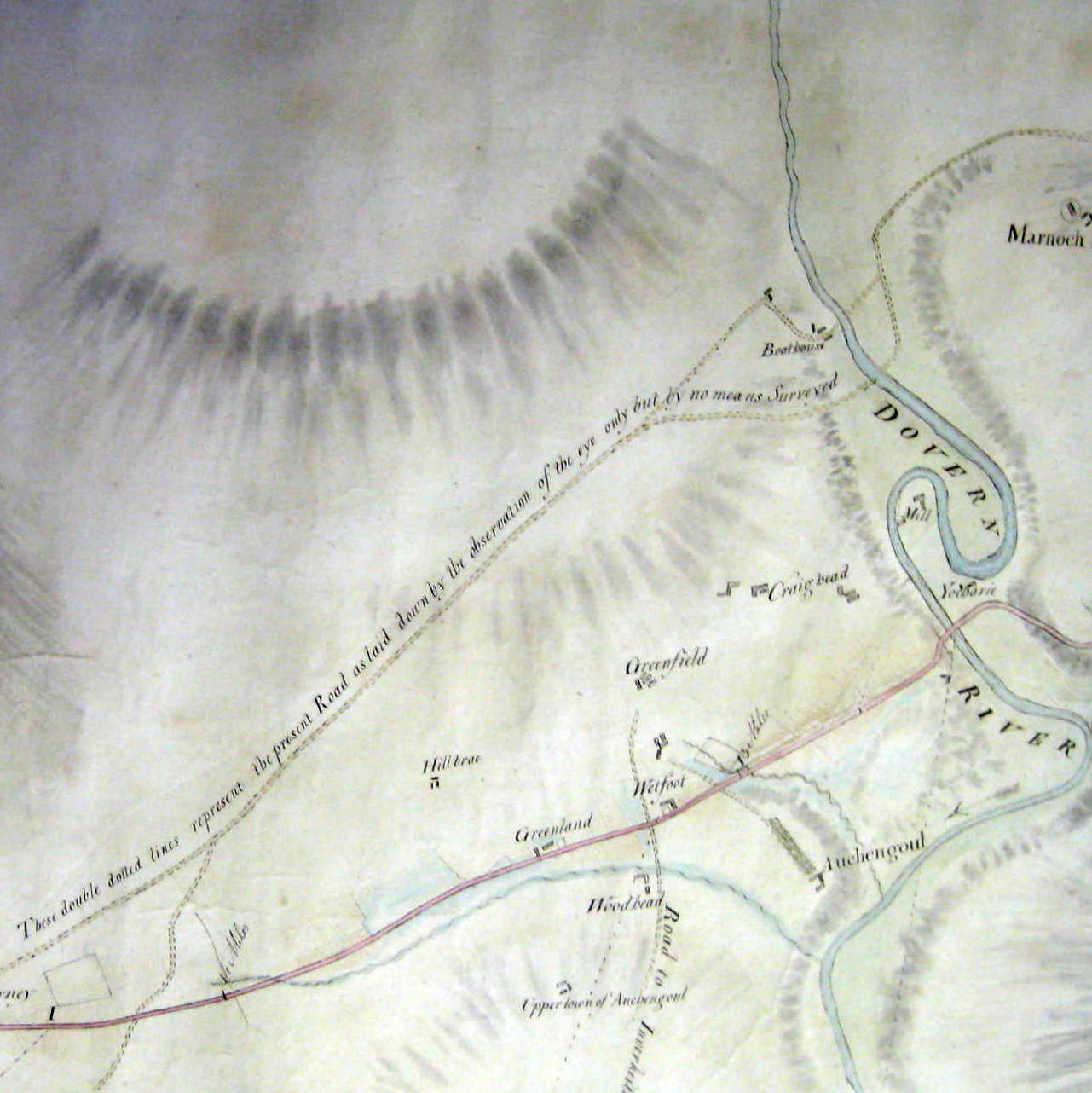
On Map 5 the turnpike route runs past Myreside and Kinnairdie Castle and across the River Deveron by the Bridge of Marnoch. Marnoch Kirk can be seen at the top of the map, while the old road from there crossing the river at Turtory is shown on Map 6.
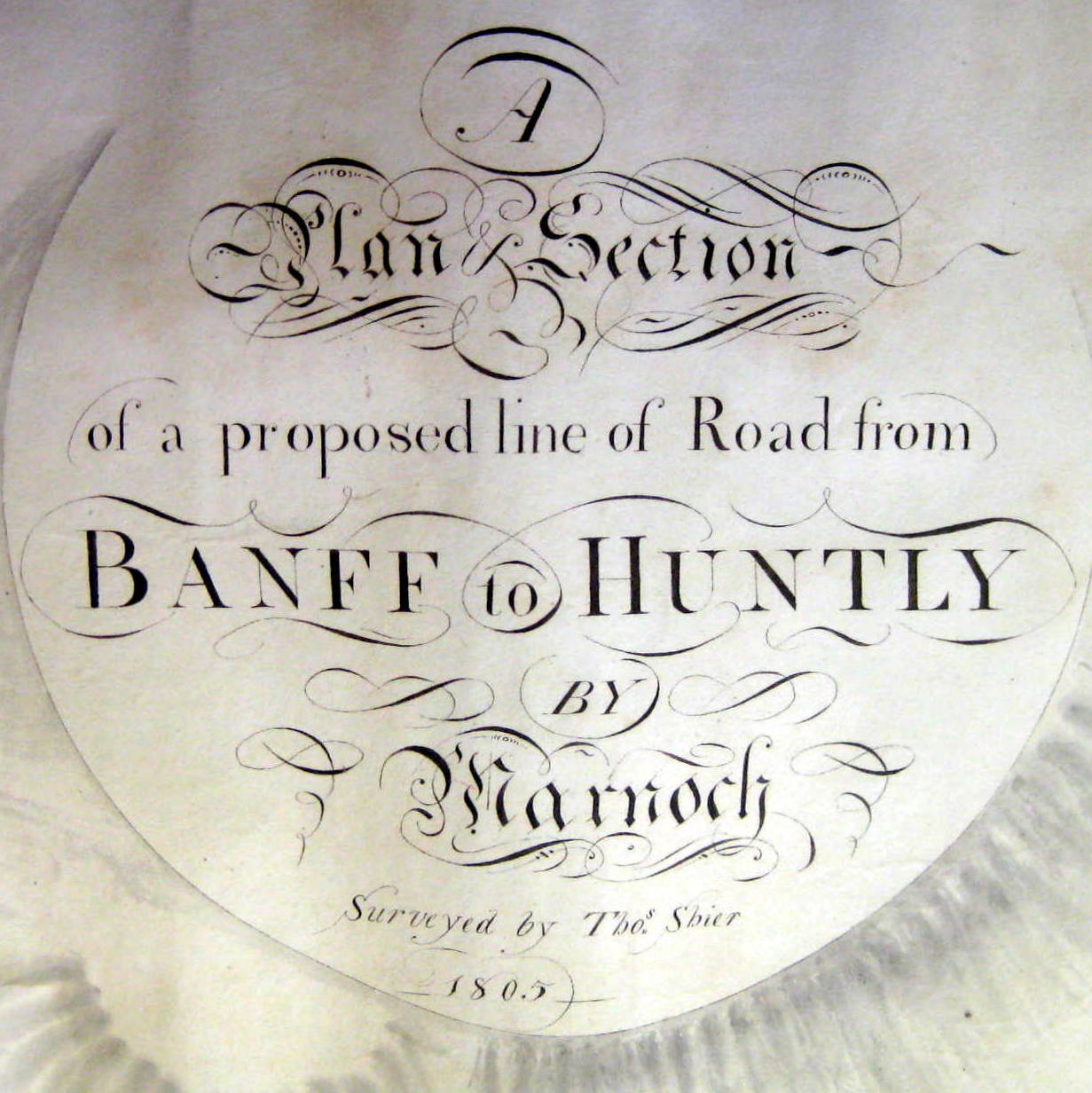
Shier Title Page
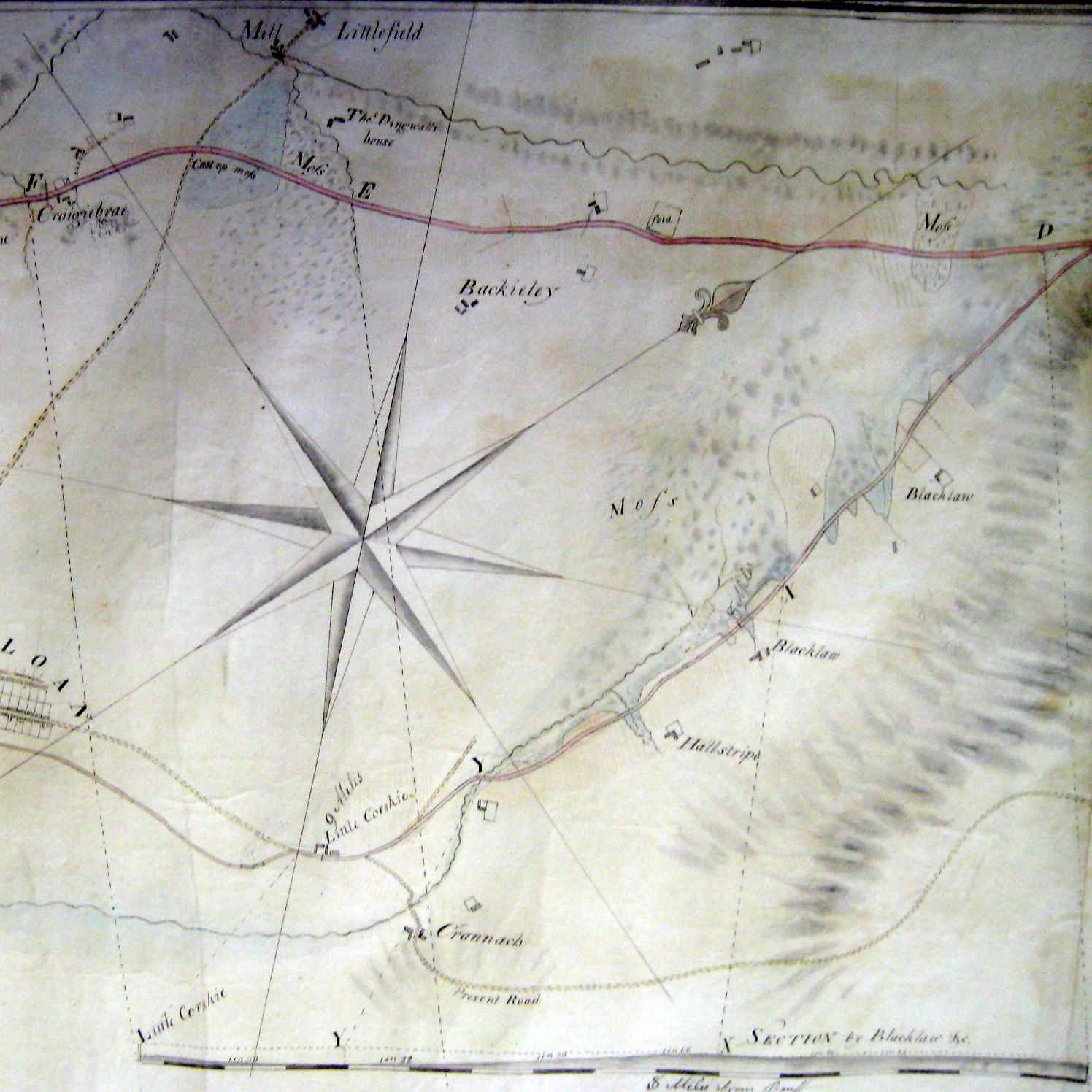
Blacklaw – Craigiebrae
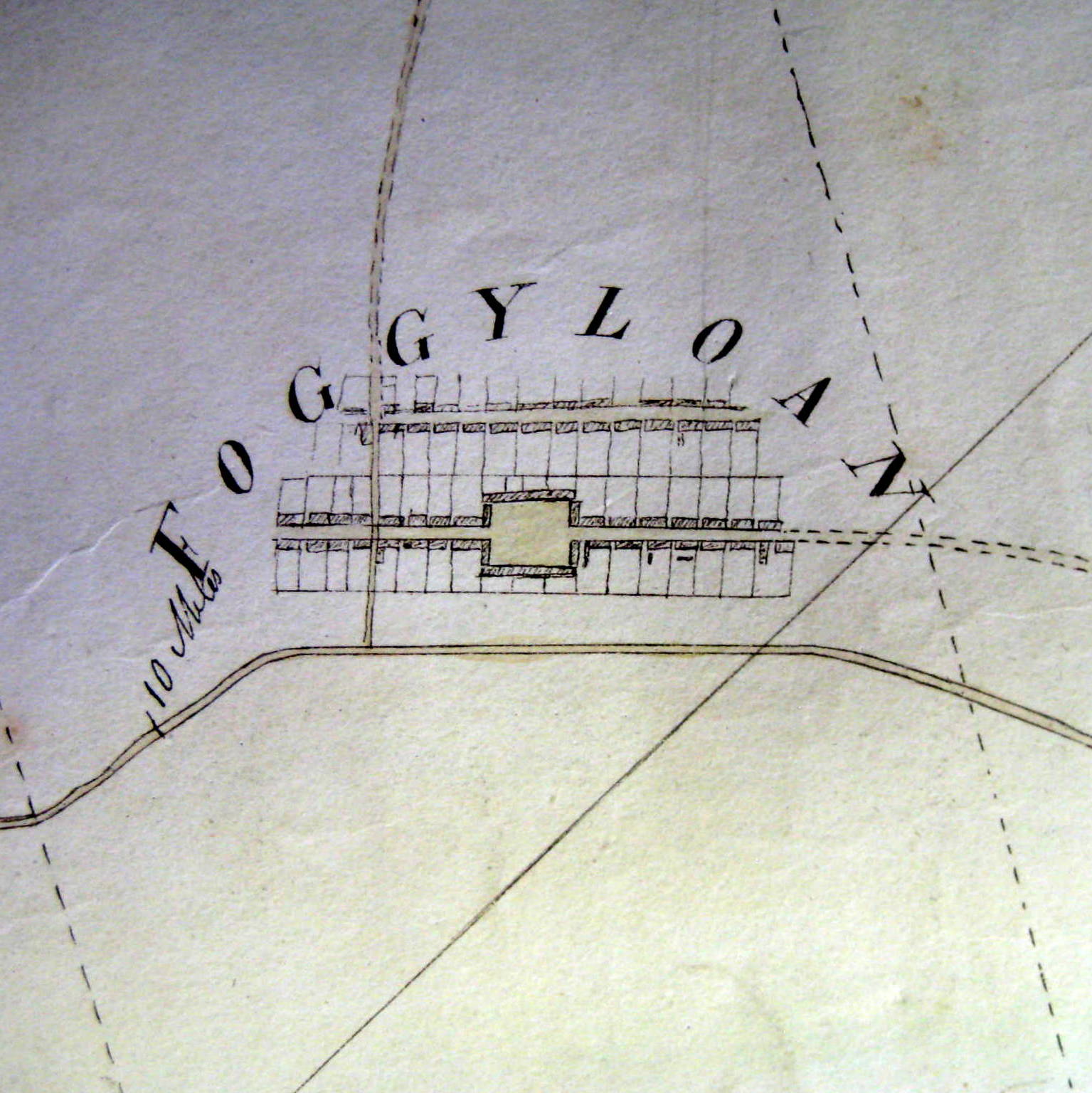
Foggyloan
Craigiebrae – Myreside
Myreside – Greenfield
Greenfield – Yonder Bognie
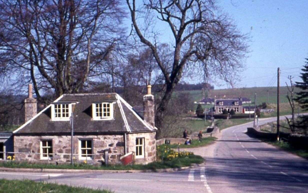
Traffic paid tolls to use turnpike roads, and you can still see the tollhouses at Bridge of Marnoch and – less easily – at Blacklaw.
The toll house on the south side of the Bridge of Marnoch is still easy to identify. At Blacklaw the toll house has been added to, and at one time was a post office. In the background are Blacklaw Garage, School and schoolhouse.
People often mistake the small octagonal house at Bridge of Auchintoul for a tollhouse on account of its shape but it was in fact the lodge at the southern entrance to Auchintoul House. This scene has hardly changed at all in the 100 years since Gammie of Turriff photographed it for one of his postcards. The South Lodge of Auchintoul House is on the right.
Marnoch Tollhouse
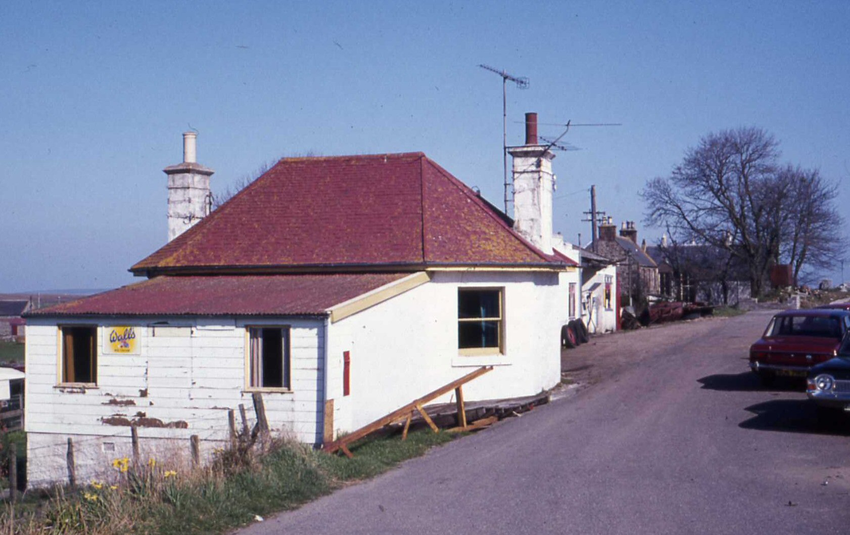
Blacklaw Tollhouse
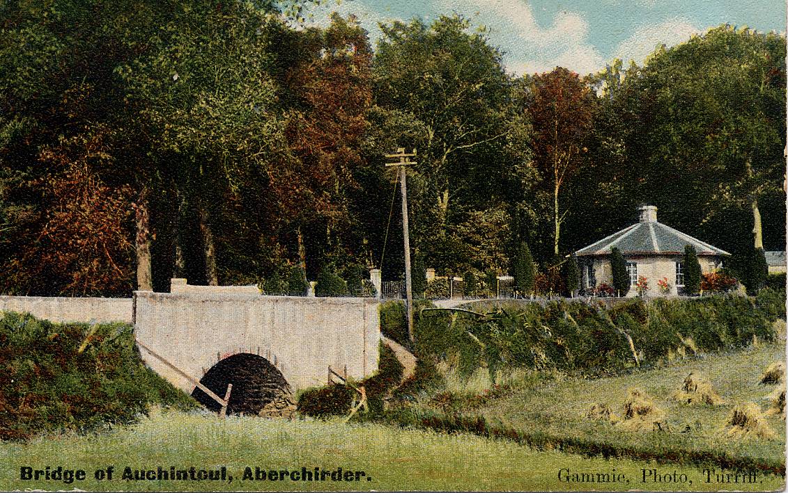
South Lodge, Auchintoul
For the next half century, the turnpike roads played their part in keeping traffic on the move. Then serious competition arrived in the form of railways which could transport goods and people much more cheaply and quickly. By 1866, turnpike tolls were abolished and the roads were taken over by local authorities.